


Basics
- Location:
- Located three miles south of Coupeville, WA
- Type:
- State Parks
Description
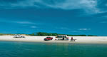
Fort Casey State Park is a 467-acre marine camping park with a lighthouse and sweeping views of Admiralty Inlet and the Strait of Juan de Fuca. A coast artillery post features two historic guns on display. The park features 10,810 feet of saltwater shoreline on Puget Sound (Admiralty Inlet), and includes Keystone Spit, a two-mile-plus stretch of land separating Admiralty Inlet and Crocket Lake.A vehicle parking permit is no longer required for day visits.
Hours + Fees
Hours:
Summer: 8 a.m. to dusk.Winter: 8 a.m. to dusk
Season:
Amenities
Amenities:
Picnic Area(s)
Map + Directions
Basic Directions
Located three miles south of Coupeville, Wash., on Whidbey Island in Puget Sound.From I-5 north:Take the Anacortes/Whidbey Island exit (#230), and drive to the Whidbey Island turnoff. From there, proceed south on Hwy. 20 to Coupeville. Follow the signs to the Keystone Ferry terminal. The park entrance sign is between the ferry terminal parking lot and the Camp Casey barracks in the 25 MPH zone.
From the Mukilteo Ferry terminal at Clinton:Take Hwy. 525 following signs to the Keystone Ferry terminal. Pass the Keystone Ferry parking lot, and take first entrance to the left.
From the south:Follow signs to the Keystone Ferry terminal. Pass ferry parking lot, and take first entrance to the left.

