Contact Info
Yankton, SD 57078
- Phone:
- 605-665-0209
Basics
- Type:
- National Park
Description
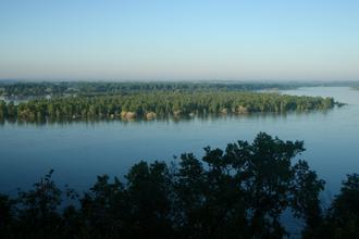
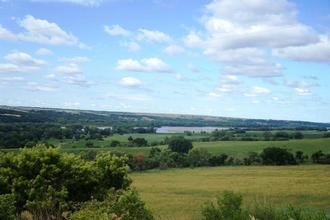
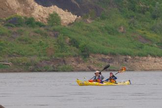
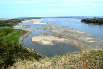
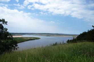
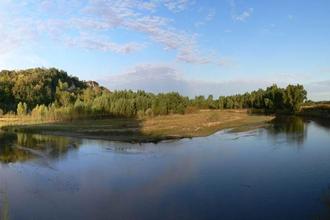
The Missouri has a history like no other river. Explore the great waterway of American Indians, fur trappers, Lewis and Clark, and many others. Experience the dynamic character of the river's ever-changing nature. View the natural beauty of the "rec river" along 100 miles of the Nebraska-South Dakota border. Listen for the eerie screech of the majestic bald eagle or the splash of a trophy fish.
Hours + Fees
Hours:
Lewis & Clark Visitor Center
Operated by the Army Corps of Engineers, this visitor center includes exhibits and includes exhibits and information on the Missouri River basin. It is located on Calumet Bluff just downstream from the Gavins Point Dam in Nebraska. To get there take Nebraska Highway 121, about 4 miles west of Yankton, South Dakota. Hours of Operation: Open 7 days a week: 9:00 a.m. to 5:00 p.m. during the warm season; Monday through Friday from 8:00 a.m. to 4:00 p.m. October through February. Closed on Federal holidays. Call 402-667-2546 for information.
Mulberry Bend Overlook
With a great view of the 59-mile reach of the river, this overlook is on the Nebraska side by the Newcastle-Vermillion (Missouri River) Bridge connecting Vermillion, South Dakota, and Newcastle, Nebraska (SD 19 and Nebraska 15). It is open year-round and may be closed in winter when conditions warrant. Wayside exhibits at the parking area tell the story of the Lewis and Clark Expedition and the historic river. A short hike to the top affords a panoramic vista of the wild and scenic Missouri.
Missouri National Recreational River Resource & Education Center
The building is located in Nebraska's Ponca State Park and houses a large exhibit wing featuring the wild and scenic Missouri River and the Missouri National Recreational River. It is open Monday through Saturday from 8:00 a.m. to 5:00 p.m. and on Sunday from 1:00 p.m. to 5:00 p.m. Hours are extended during the summer. The state park is at the end of Highway Spur 26 E about three miles north of Ponca. A valid daily or annual entry permit is required. To learn more call: 402-755-2284.
Price Details:
There are no fees to enter Missouri National Recreational River or the Lewis and Clark Visitor Center adjacent to Gavins Point Dam. However, our state park partners do charge.
Map + Directions
Basic Directions
Directions to Park Headquarters
Located at 508 East Second Street in Yankton
- From US Highway 81 in Nebraska: Cross the bridge into South Dakota and take the first right onto Second Street. Go east about 5 blocks; the office will be on your left.
- From US Highway 81 in South Dakota: Go through Yankton and take the last left turn before the bridge (2nd St.). Go east about 5 blocks; the office will be on your left.
- From US Highway 50 west of Yankton: Turn right on Highway 81, go through Yankton and take the last left turn before the bridge (2nd St.). Go east about 5 blocks; the office will be on your left.
- From US Highway 50 East of Yankton: Turn left at the first stoplight (Burleigh/Second St.) The park office is the first building on the right.
Directions to the Lewis and Clark Visitor Center
This is one of the the main public contact points for the park.
Located at 55245 Nebraska Highway 121, Crofton, NE 68730
- From US 81 in South Dakota: Cross the Missouri River on US 81 South. After 2 miles turn right (heading west) onto Nebraska Route 121. Continue on 121, following it to the left after 4 miles and drive to the top of the hill. The visitor center parking lot entrance is on the right. Or
- From US 81 in Nebraska: Drive north on US 81 toward Yankton. Turn left onto Nebraska Route 121, following it to the left after 4 miles and drive to the top of the hill. The visitor center parking lot entrance is on the right.
- From Yankton: Take South Dakota Route 52 west from Yankton six miles to the road that crosses the dam (Crest Road). Turn left onto the Crest Road (heading south). Follow this road across the dam and take the first road to the right, Nebraska Route 121. Turn right and drive up the hill. The visitor center parking lot entrance is on the right.
Directions to the Fort Randall Visitor Center
This center provides an excellent view of the Missouri River and Fort Randall Dam.
Located near Pickstown, S.D., River Mile 880.0
- From US 46 in South Dakota: After leaving Wagner, S.D., drive 16 miles west, turn right at Fort Randall Visitor Center, just on the east side of Fort Randall Dam. Or
- From US 18 and 46 in South Dakota: Driving east on US 18 from Bonesteel, S.D. for 29 miles cross Fort Randall Dam onto US 46. Take the first left after crossing the dam to the Fort Randall Visitor Center.


